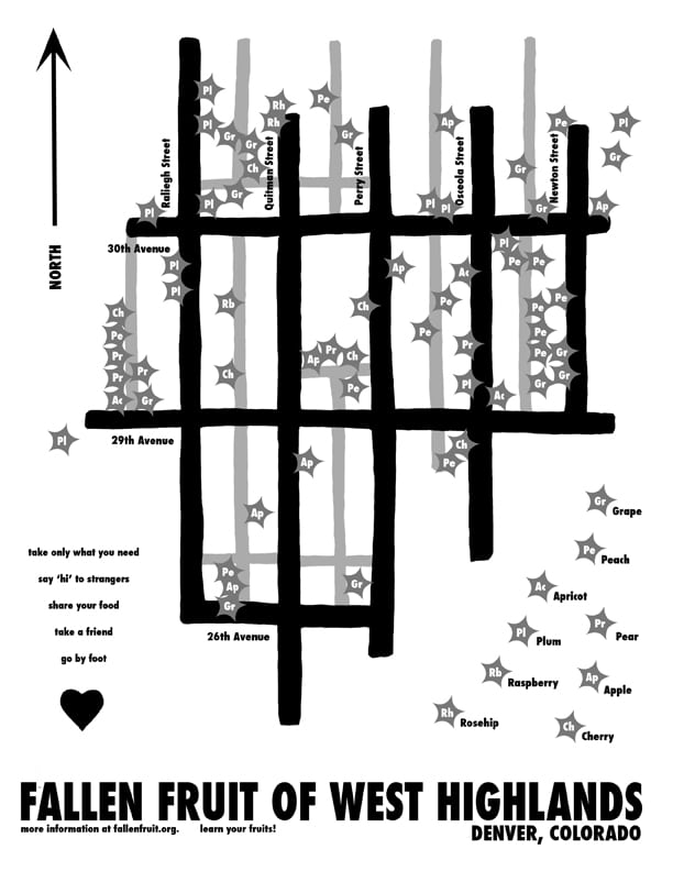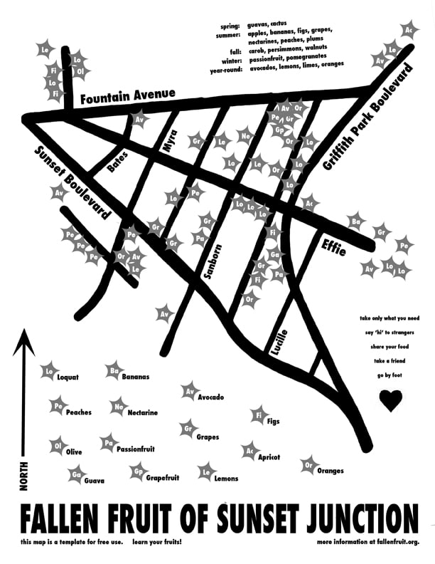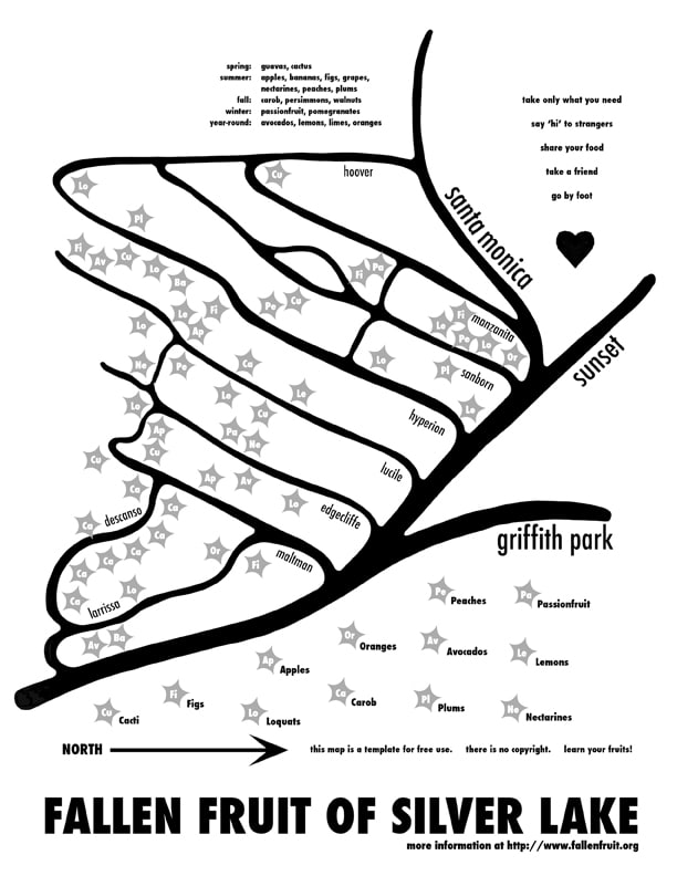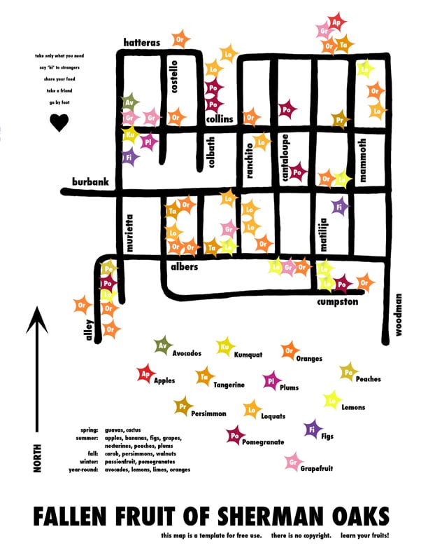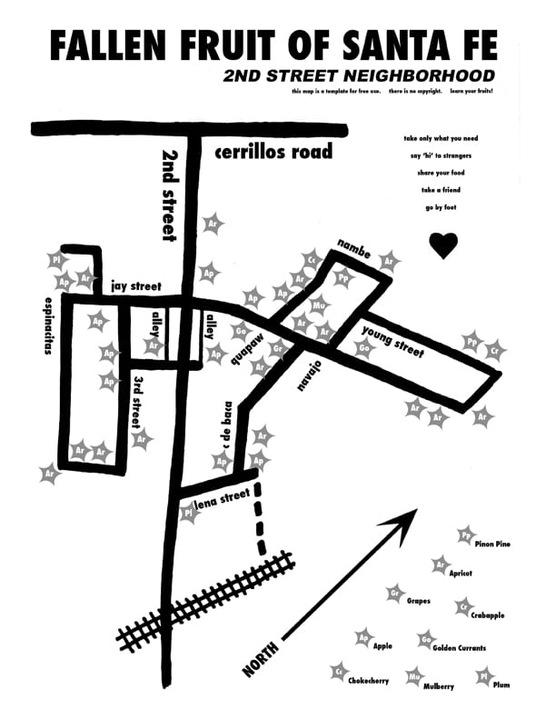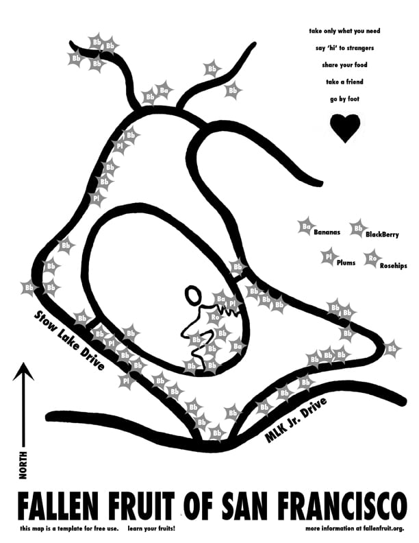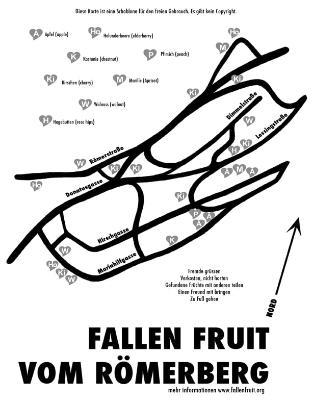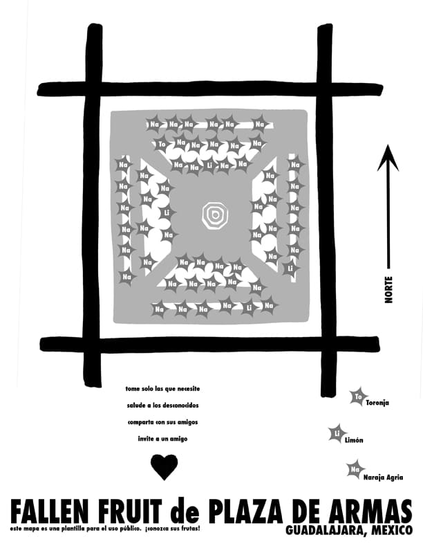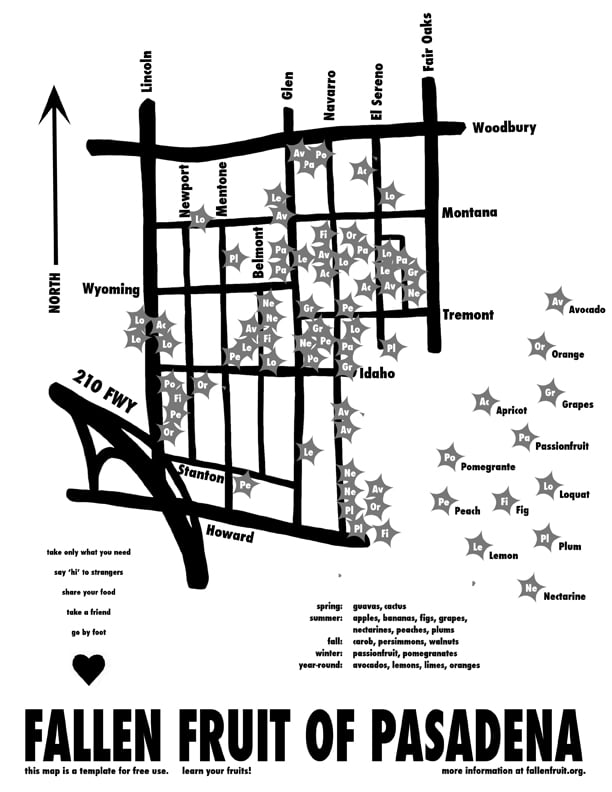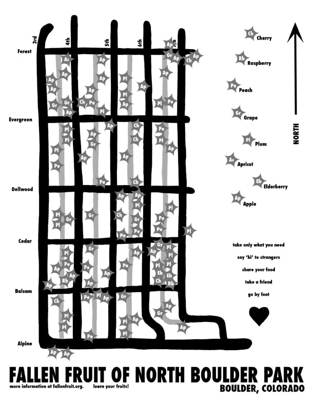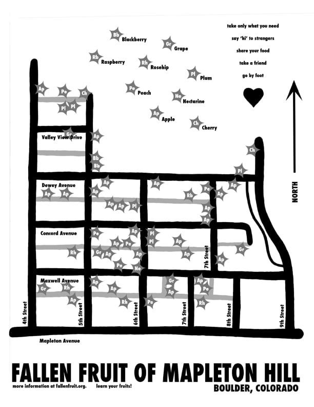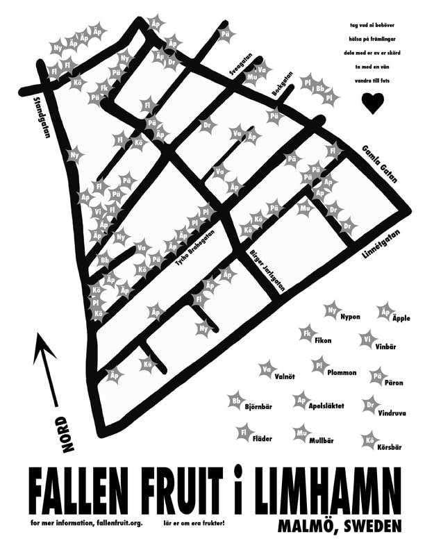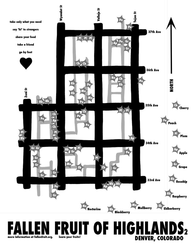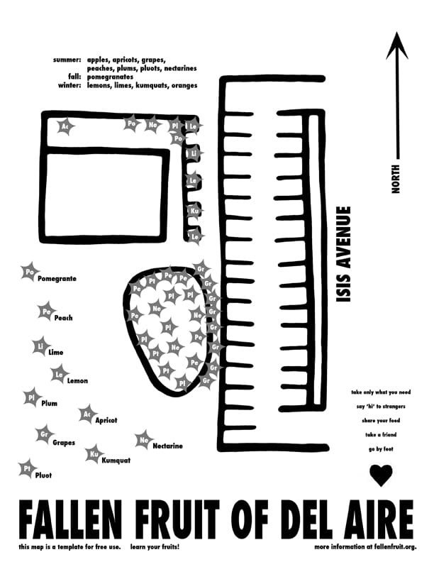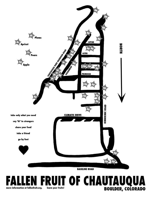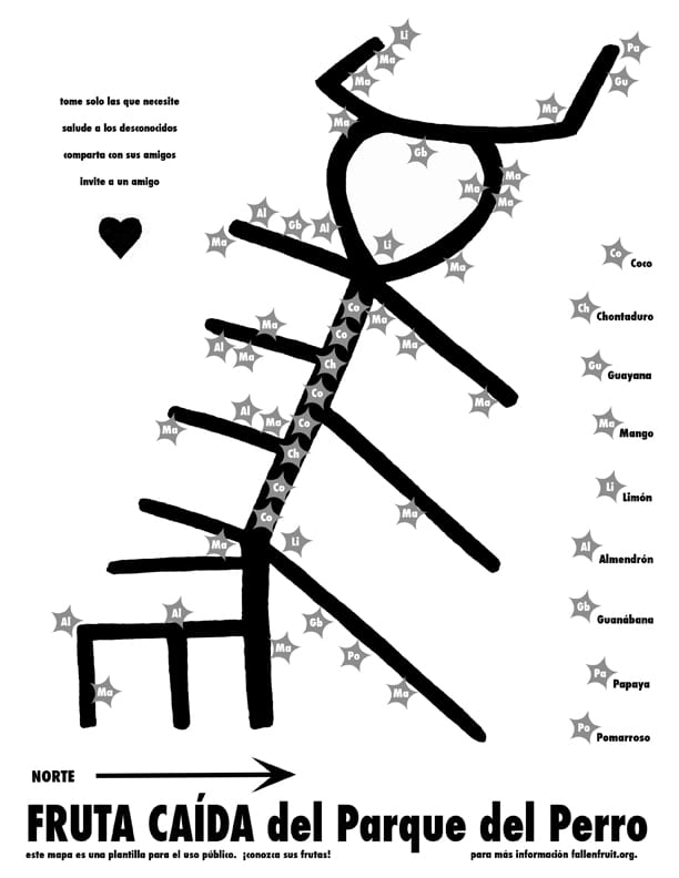
Public Fruit Maps
Public Fruit Maps, dimensions variable, 2004 – ongoing
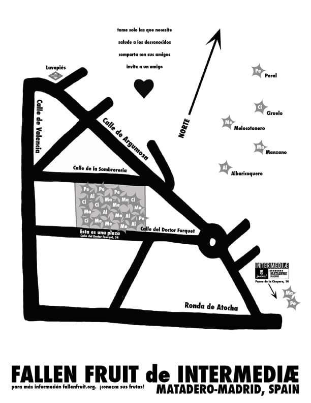
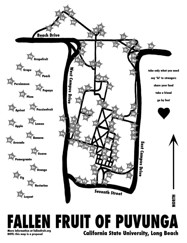
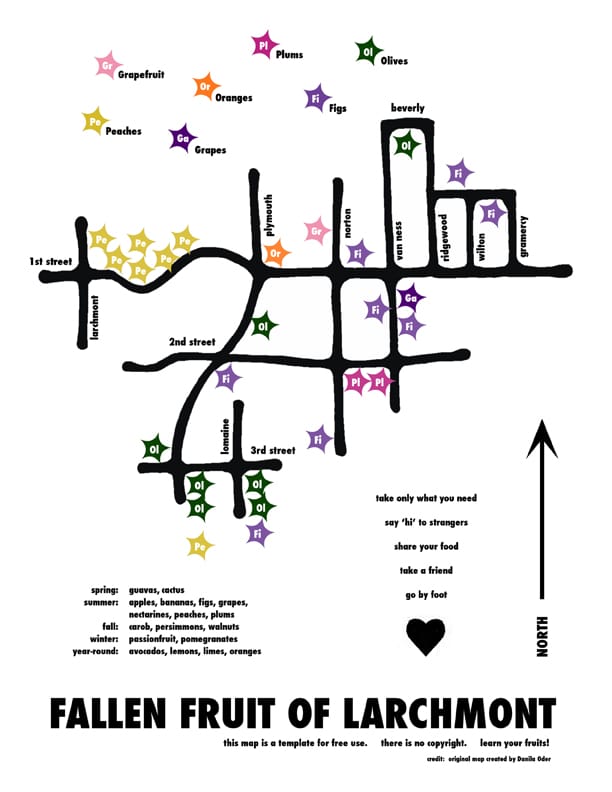
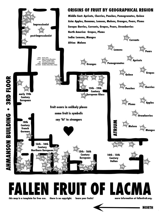
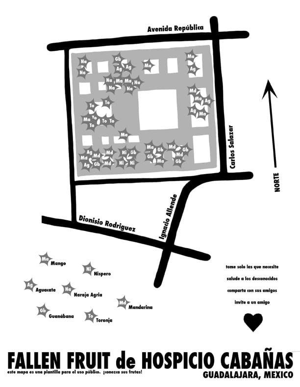
One of Fallen Fruit’s core projects is to map neighborhoods, mapping all the fruit trees that grow in or over public space. Only pick fruit that is on public space unless you have permission from the property owner. You can find all of our maps at Endless Orchard. If you want to contribute to our online maps- email us! The maps are hand-drawn and distributed free from copyright as jpgs and PDFs. They have been exhibited in museums and gallery exhibitions internationally. The dimensions of the maps are variable and range from 8″ x 10″ to 40″ x 60″. This is an ongoing and ever-expanding project.
NOTE: These maps are for entertainment purposes only. Never trespass or take fruit from private property. Only pick fruit that is clearly in public space- for example hanging over the sidewalk or in the parkway. If you are not sure, ask the home owner. We look forward to having you onboard!